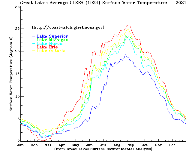
The Great Lakes Surface Environmental Analysis (GLSEA) is a digital map of the Great Lakes surface water temperature and ice cover which is produced daily. The lake surface temperatures are satellite-derived from NOAA Advanced Very High Resolution Radar (AVHRR), Visible Infrared Imaging Radiometer Suite onboard the Suomi National Polar-Orbiting Partnership spacecraft (VIIRS S-NPP), and NOAA-20 Visible Infrared Imaging Radiometer Suite ( VIIRS NOAA-20) imagery obtained through the NOAA Great Lakes CoastWatch program. Ice cover concentration is added using data provided by the National Ice Center. Lake surface temperatures are updated daily with information from the cloud-free portions of the previous day’s satellite imagery (+/- 10 days). If no satellite imagery is available, a smoothing algorithm is applied.
-
GLSEA Average Surface Water Temperature