Available data products by category:
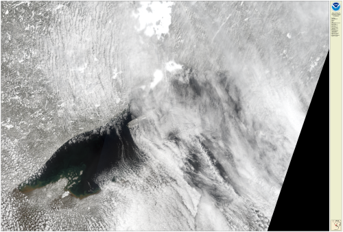
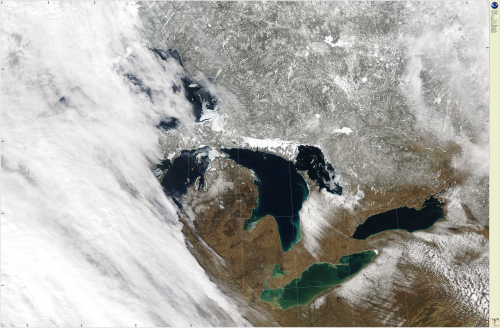
True Color
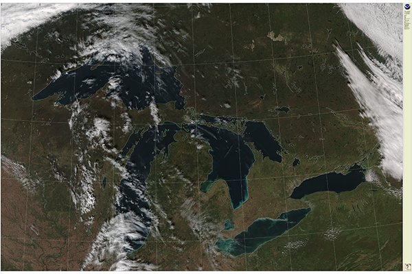
True color images look similar to a “photograph” of the earth and lakes from a space-borne satellite perspective.
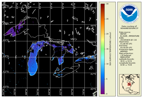
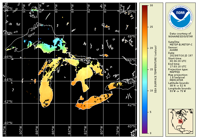
Sea Surface Temperature (SST)
Sea surface temperature, or lake surface temperature, is used to understand how the lake communicates with the Earth’s atmosphere.
Ice Products
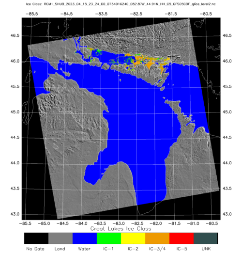
Researchers and stakeholders use Synthetic Aperture Radar (SAR) data from the NOAA CoastWatch Great Lakes Node to monitor the ice conditions.
Ice Cover Classification
Data from the NOAA CoastWatch Great Lakes Node to monitor six different types of ice, ice thickness, and ice cover.
Color Producing Agents: Chlorophyll
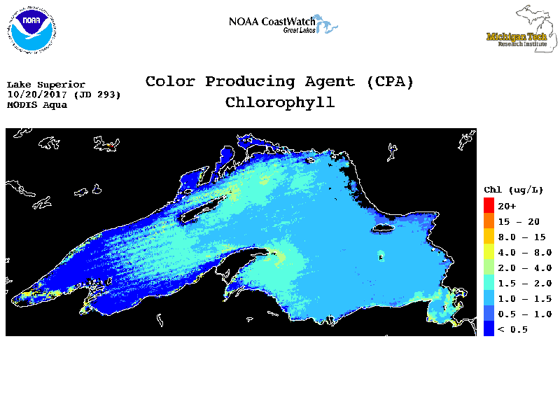
Chlorophyll is an estimation of the concentration of the phytoplankton pigment, chlorophyll-a, at the lake surface and it is used as a proxy for the amount of phytoplankton in the surface water.
Color Producing Agents: Suspended Minerals

Utilizes MERIS, MODIS, or SeaWiFS satellite data to estimate chlorophyll (chl), dissolved organic carbon (doc) and suspended minerals (sm), the three primary Color Producing Agents (CPAs).
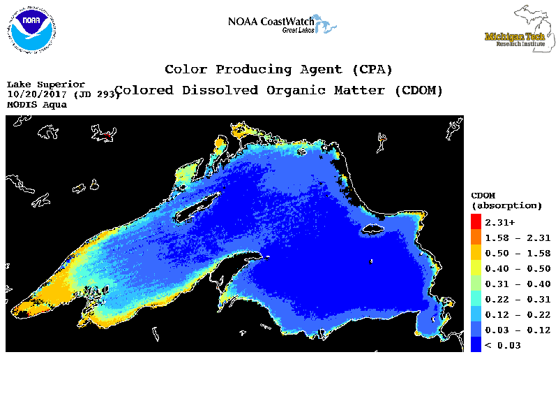
Color Producing Agents: Dissolved Organic Matter
Color Producing Agents: Dissolved Organic Carbon
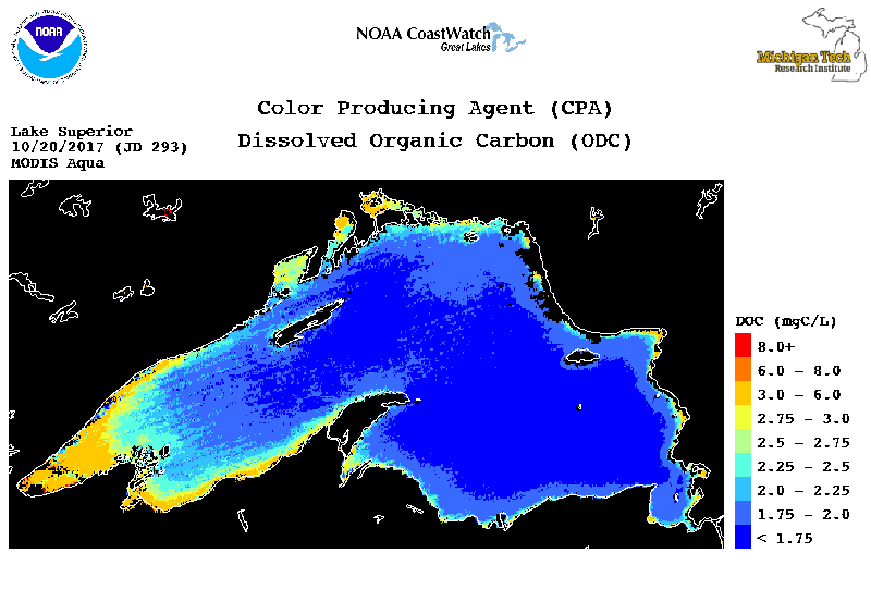
Utilizes MERIS, MODIS, or SeaWiFS satellite data to estimate chlorophyll (chl), dissolved organic carbon (doc) and suspended minerals (sm), the three primary Color Producing Agents (CPAs).
Color Producing Agents: Light Attenuation
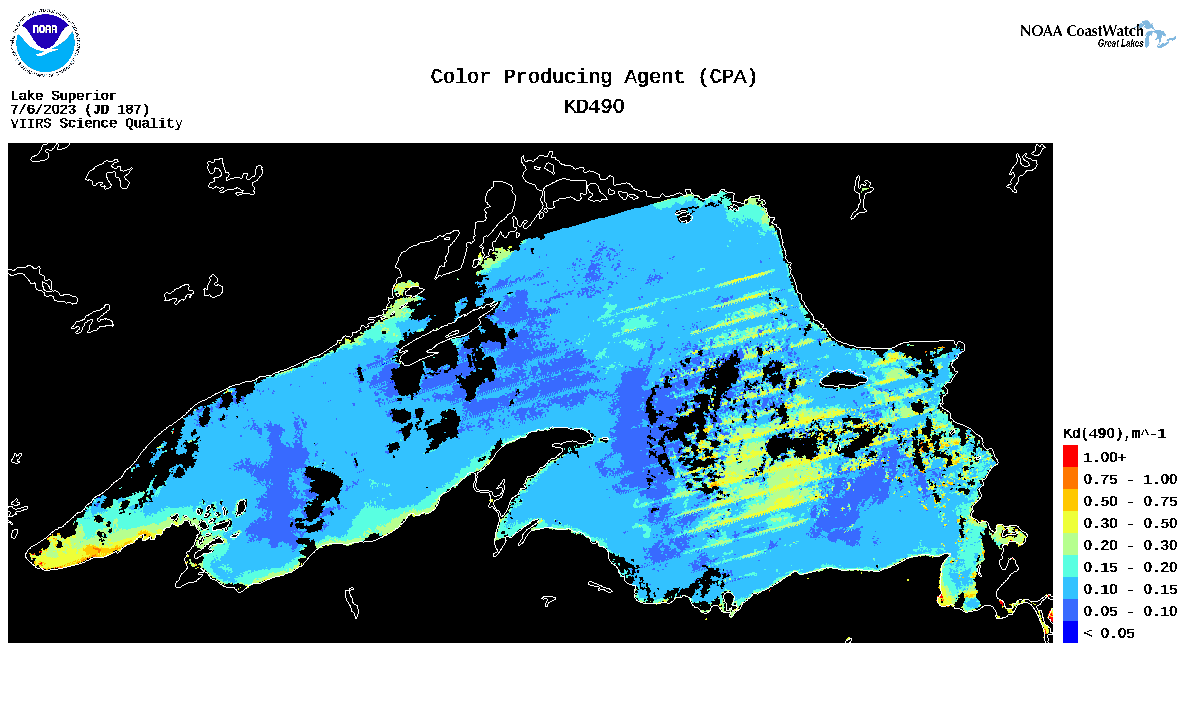
Utilizes MERIS, MODIS, or SeaWiFS satellite data to estimate chlorophyll (chl), dissolved organic carbon (doc) and suspended minerals (sm), the three primary Color Producing Agents (CPAs).
SAR Winds
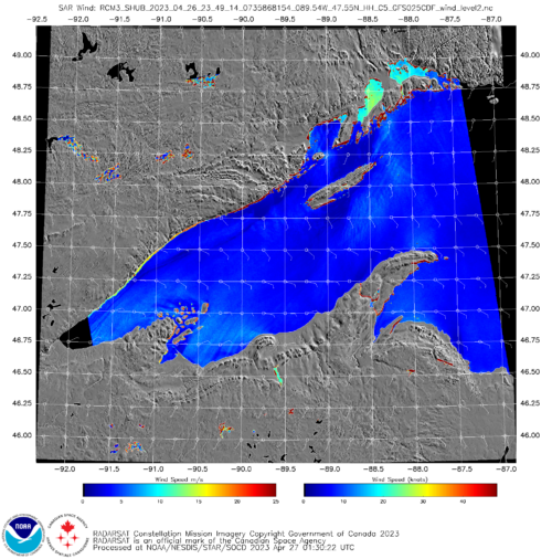
The Great Lakes SAR wind data files produced at National Environmental Satellite Data and Information Service (NESDIS) Center for Satellite Applications and Research (STAR) SAR term and hosted at the CoastWatch Great Lakes node.
Surface Temperature Contours Maps
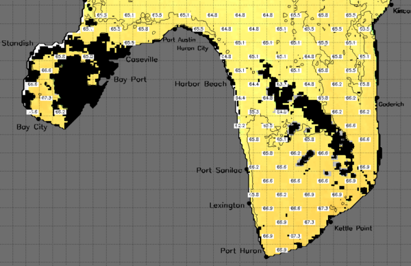
Contour maps of each port region are also hosted on the Great Lakes CoastWatch node and are in near-real time when the satellite passes over the Great Lakes (up to 18 images a day from different satellites).
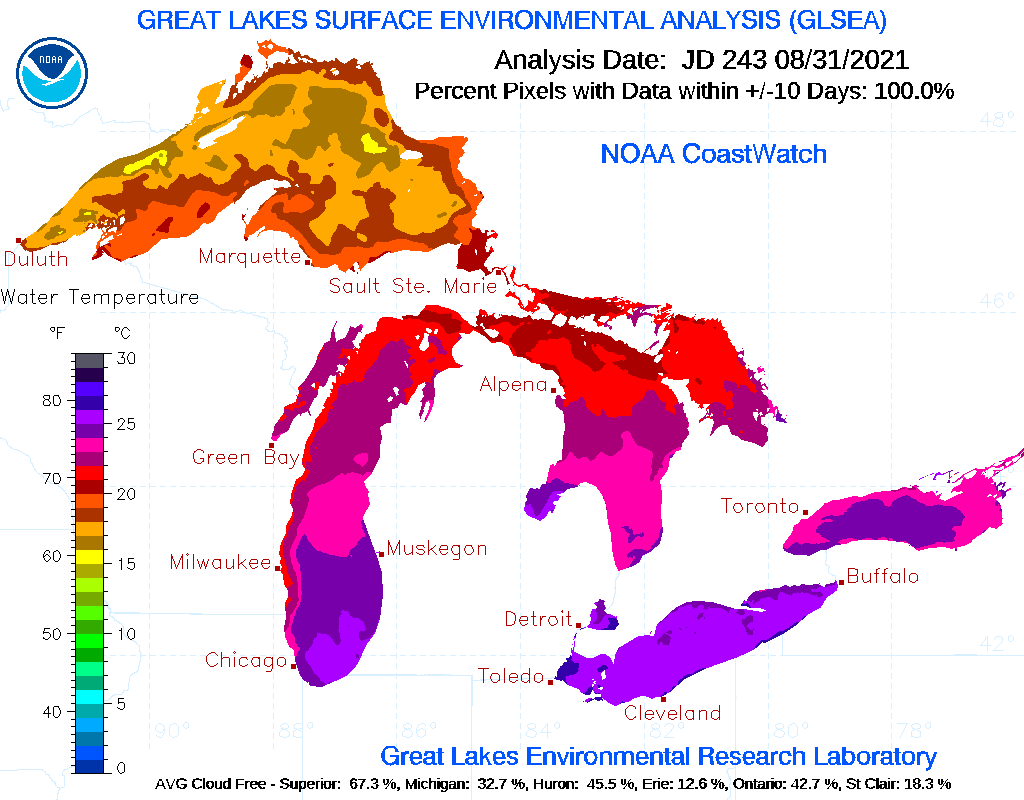
GLSEA Daily
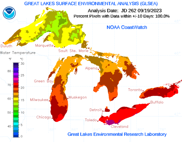
Great Lakes Surface Environmental Analysis full resolution images of the day.
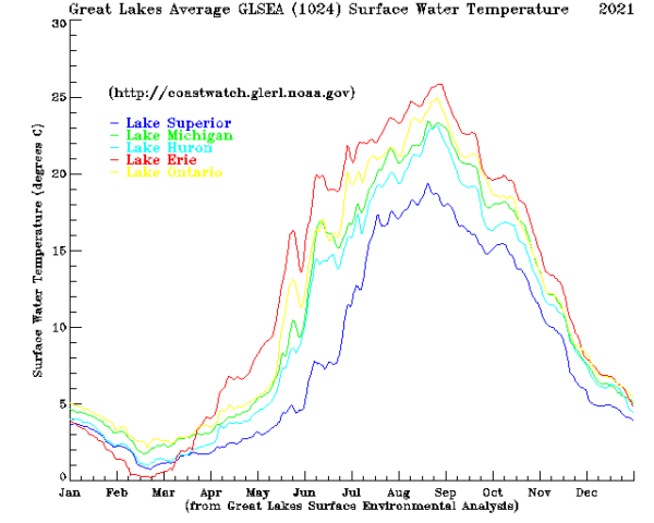
GLSEA Annual Comparison
Present day average compared to prior years.
GLSEA Lake Surface Temperature
Lake surface temperatures are updated daily with information from the cloud-free portions of the previous day’s satellite imagery
Available data products by satellite:
AVHRR
Data from the Advanced Very High Resolution Radiometer (AVHRR) aboard a series of National Oceanic and Atmospheric Administration (NOAA) Polar-orbiting Operational Environmental Satellites (POES).
VIIRS
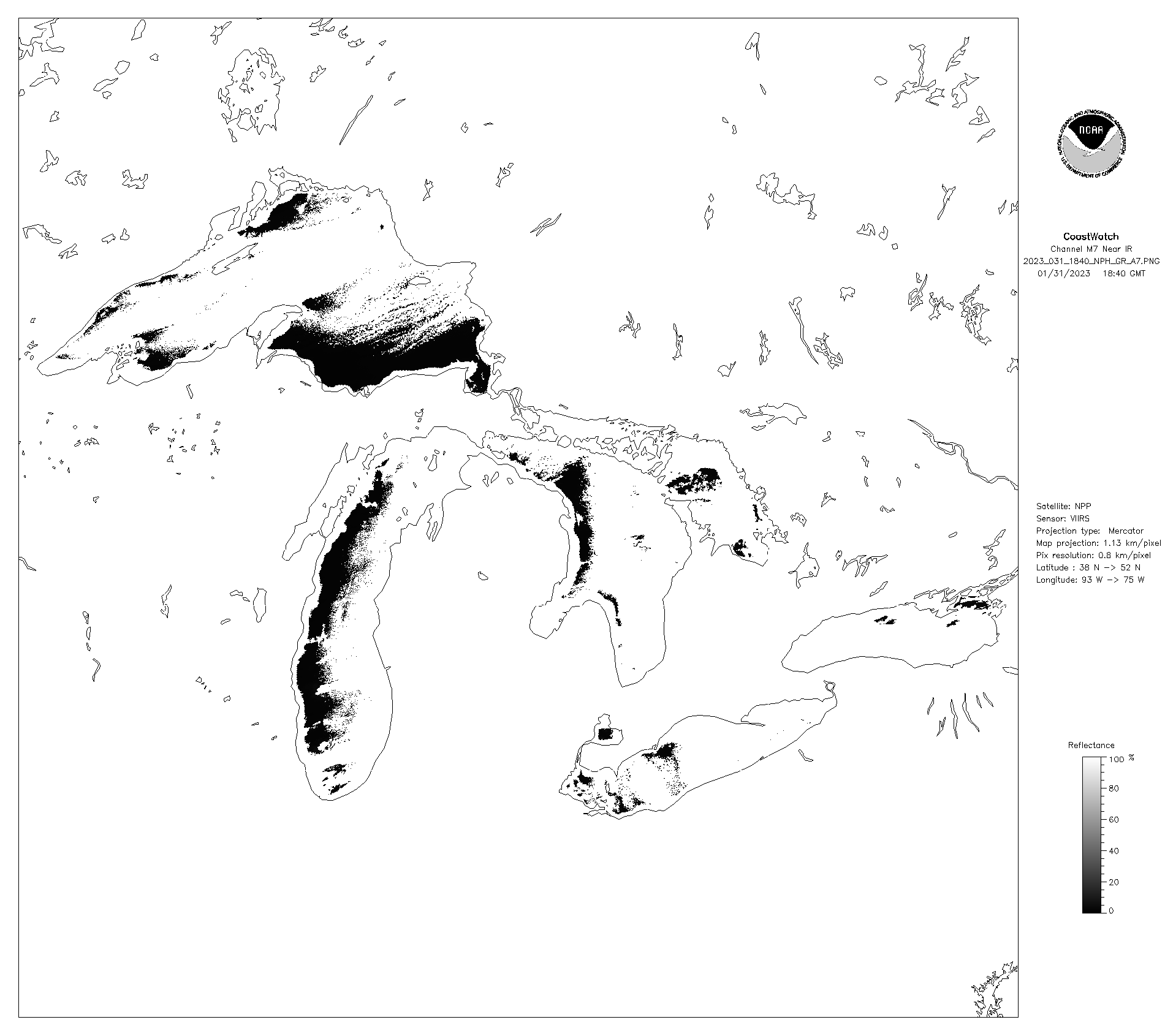
The Visible Infrared Imaging Radiometer Suite (VIIRS) is a sensor designed and manufactured by the Raytheon Company on board the polar-orbiting Suomi National Polar-orbiting Partnership (Suomi NPP) and NOAA-20 weather satellite.
OLCI
MODIS
MODIS is a key instrument aboard the Terra and Aqua satellites. Terra’s orbit around the Earth is timed so that it passes from north to south across the equator in the morning, while Aqua passes south to north over the equator in the afternoon.
GOES
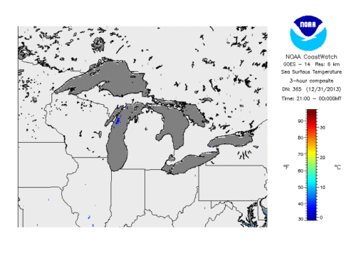
GOES satellites continually view the Western Hemisphere from approximately 22,300 miles above Earth. The National Aeronautics and Space Administration (NASA) builds and launches the GOES, and the National Oceanic and Atmospheric Administration (NOAA) operates them.
Sentinel 1A/B
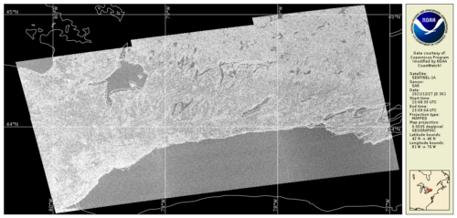
The Sentinel-1 mission comprises a constellation of two polar-orbiting satellites, operating day and night performing C-band synthetic aperture radar (SAR) imaging, enabling them to acquire imagery regardless of the weather.
ACSPO
Advanced Clear Sky Processor for Ocean (ACSPO) is the NOAA Enterprise SST system. NOAA CoastWatch co-gridded VIIRS SST products are Level 3 daily composites in compatible format and projection with other CoastWatch Level 3 sector and global products.